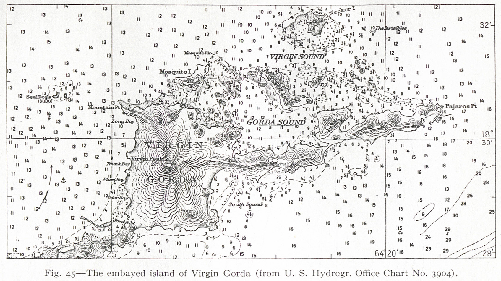
Fig. 45 — The embayed island of Virgin Gorda (from U. S. Hydrogr. Office Chart No. 3904).
Contenu
-
Identifiant (dcterms:identifier)
-
NAN130340151i1
-
Légende (dcterms:title)
-
Fig. 45 — The embayed island of Virgin Gorda (from U. S. Hydrogr. Office Chart No. 3904).
-
Page (bibo:locator)
-
p. 119
-
Numéro (bibo:number)
-
119
-
Description (dcterms:description)
-
Carte topographique des sendiments de l'île de Virgin Gorda
-
Mot-clé Siècle (dcterms:temporal)
-
19
-
Type (dcterms:type)
-
fr
Carte, plan
-
Format (dcterms:format)
-
image/jpeg
-
Conditions d'utilisation (dcterms:rights)
-
fr
Domaine public
-
Plateforme source (dcterms:provenance)
-
Bibliothèque numérique Manioc
Ressources liées
Contenus avec " Contient : Fig. 45 — The embayed island of Virgin Gorda (from U. S. Hydrogr. Office Chart No. 3904). "
| Titre |
Classe |
 The Lesser Antilles The Lesser Antilles |
Texte
|
 Service commun de la documentation de l’Université de Nantes