Borrador topografico de la linea divisoria
Contenu
-
Identifiant (dcterms:identifier)
-
B_CG973FRAN_RES_004-15008_001_0028
-
Légende (dcterms:title)
-
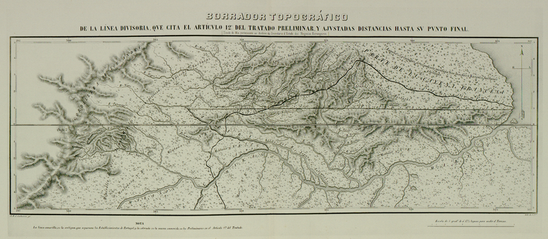
Borrador topografico de la linea divisoria
-
Page (bibo:locator)
-
n°28
-
Numéro (bibo:number)
-
28
-
Description (dcterms:description)
-
Carte officielle et définitive du Traité de 1750 entre l'Espagne et le Portugal. Frontière française au cap de Nord, à un degré et une fraction
-
Mot-clé Siècle (dcterms:temporal)
-
18
-
Type (dcterms:type)
-
fr
Carte, plan
-
Format (dcterms:format)
-
image/jpeg
-
Conditions d'utilisation (dcterms:rights)
-
fr
Domaine public
-
Plateforme source (dcterms:provenance)
-
Bibliothèque numérique Manioc
 Mémoire contenant l'exposé des droits de la France dans la question des frontières de la Guyane française et du Brésil soumise à l'arbitrage du gouvernement de la Confédération suisse. Atlas
 Bibliothèque Alexandre-Franconie

