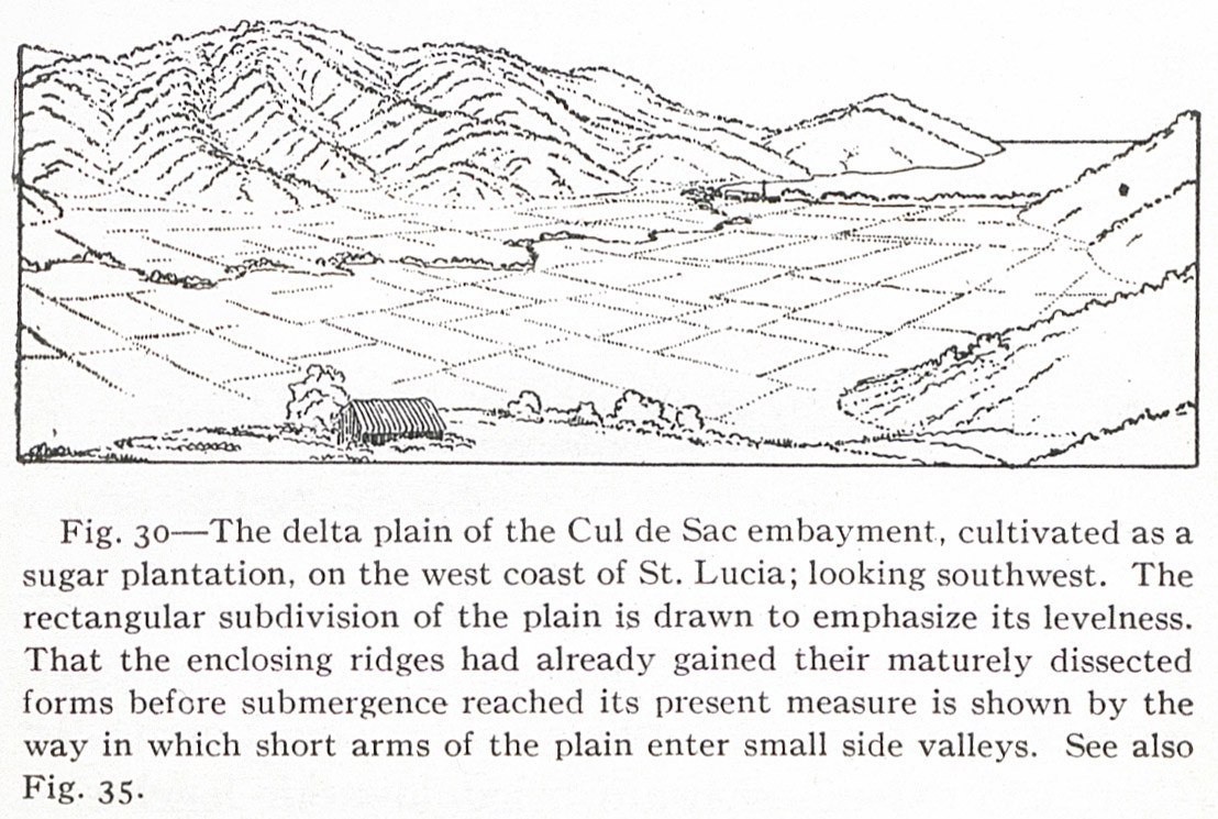
Fig. 30 — The delta plain of the Cul de Sac embayment, cultivated as a sugar plantation, on the west coast of St. Lucia; looking southwest. The rectangular subdivision of the plain is drawn to emphasize its levelness. That the enclosing ridges had already gained their maturely dissected forms before submergence reached its present measure is shown by the way in which short arms of the plain enter small side valleys. See also Fig. 35.
Contenu
-
Identifiant
-
NAN130340111i1
-
Légende
-
Fig. 30 — The delta plain of the Cul de Sac embayment, cultivated as a sugar plantation, on the west coast of St. Lucia; looking southwest. The rectangular subdivision of the plain is drawn to emphasize its levelness. That the enclosing ridges had already gained their maturely dissected forms before submergence reached its present measure is shown by the way in which short arms of the plain enter small side valleys. See also Fig. 35.
-
Page
-
p. 83
-
Numéro
-
83
-
Description
-
Le Delta plain du Cul de Sac enfoncement, cultivé en canne à sucre du côté Ouest de Sainte Lucie
-
Mot-clé Siècle
-
19
-
Type
-
Dessin, estampe, peinture
-
Format
-
image/jpeg
-
Conditions d'utilisation
-
fr
Domaine public
-
Plateforme source
-
Bibliothèque numérique Manioc
Ressources liées
Contenus avec " Contient : Fig. 30 — The delta plain of the Cul de Sac embayment, cultivated as a sugar plantation, on the west coast of St. Lucia; looking southwest. The rectangular subdivision of the plain is drawn to emphasize its levelness. That the enclosing ridges had already gained their maturely dissected forms before submergence reached its present measure is shown by the way in which short arms of the plain enter small side valleys. See also Fig. 35. "
| Titre |
Classe |
 The Lesser Antilles The Lesser Antilles |
Texte
|