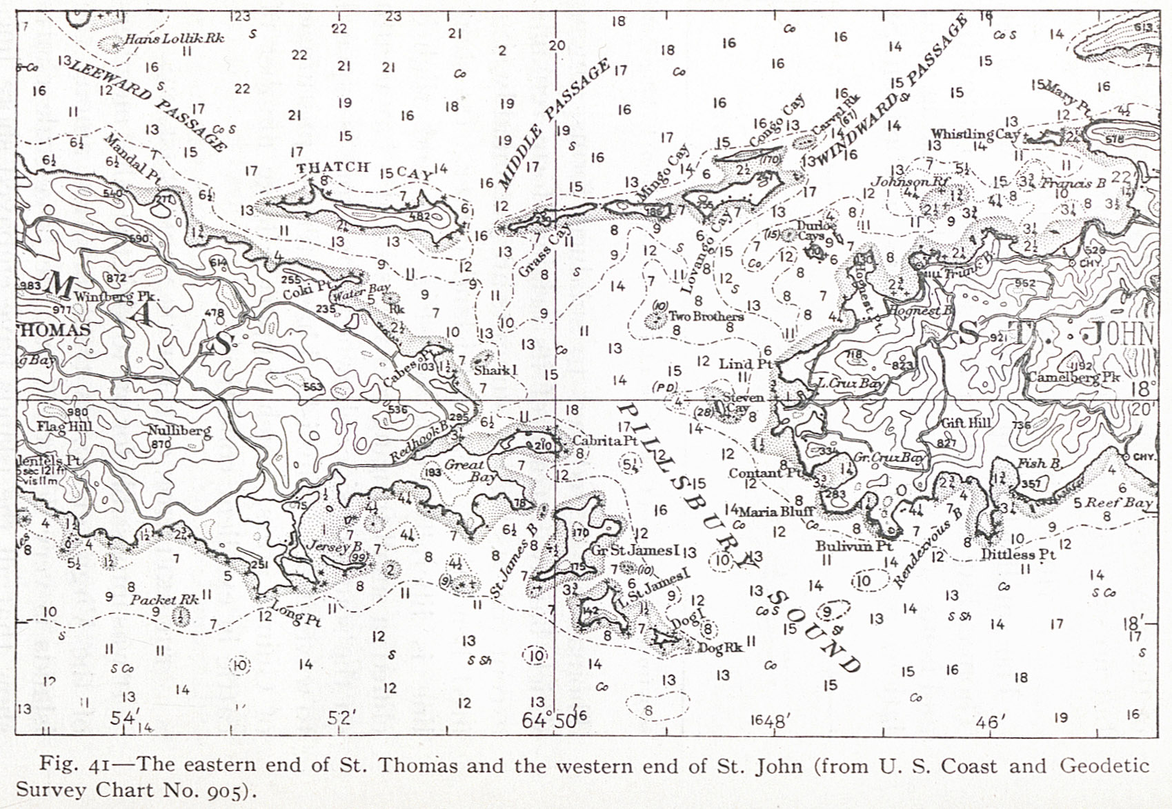
Fig. 41 — The eastern end of St. Thomas and the western end of St. John (from U. S. Coast and Geodetic Survey Chart No. 905).
Contenu
-
Identifiant
-
NAN130340146i1
-
Légende
-
Fig. 41 — The eastern end of St. Thomas and the western end of St. John (from U. S. Coast and Geodetic Survey Chart No. 905).
-
Page
-
p. 114
-
Numéro
-
114
-
Description
-
Carte de la grande extrémité de Saint Thomas et l'extrême Ouest de Saint John
-
Mot-clé Siècle
-
19
-
Type
-
fr
Carte, plan
-
Format
-
image/jpeg
-
Conditions d'utilisation
-
fr
Domaine public
-
Plateforme source
-
Bibliothèque numérique Manioc
Ressources liées
Contenus avec " Contient : Fig. 41 — The eastern end of St. Thomas and the western end of St. John (from U. S. Coast and Geodetic Survey Chart No. 905). "
| Titre |
Classe |
 The Lesser Antilles The Lesser Antilles |
Texte
|