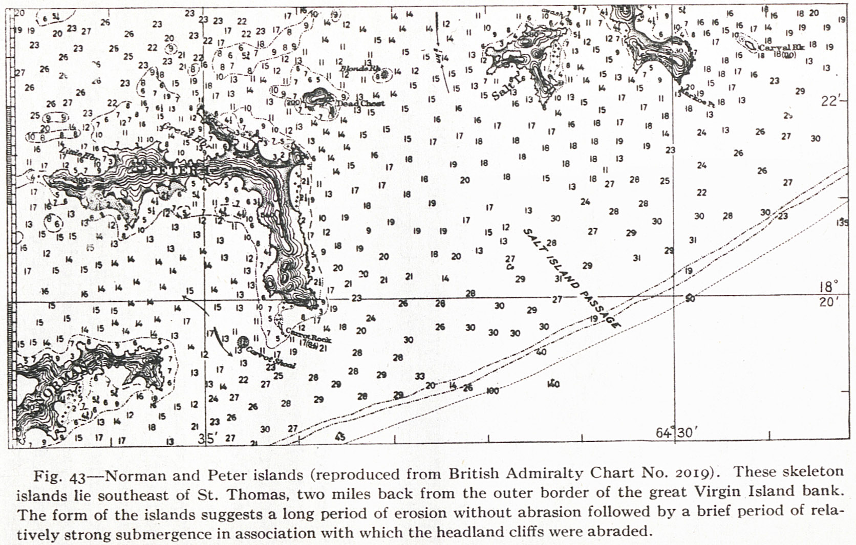
Fig. 43 — Norman and Peter islands (reproduced from British Admiralty Chart No. 2019). These skeleton islands lie southeast of St. Thomas, two miles back from the outer border of the great Virgin Island bank. The form of the islands suggests a long period of erosion without abrasion followed by a brief period of relatively strong submergence in association with which the headland cliffs were abraded.
Contenu
-
Identifiant
-
NAN130340148i1
-
Légende
-
Fig. 43 — Norman and Peter islands (reproduced from British Admiralty Chart No. 2019). These skeleton islands lie southeast of St. Thomas, two miles back from the outer border of the great Virgin Island bank. The form of the islands suggests a long period of erosion without abrasion followed by a brief period of relatively strong submergence in association with which the headland cliffs were abraded.
-
Page
-
p. 116
-
Numéro
-
116
-
Description
-
Carte topographique des 'îles Norman et Peter
-
Mot-clé Siècle
-
19
-
Type
-
fr
Carte, plan
-
Format
-
image/jpeg
-
Conditions d'utilisation
-
fr
Domaine public
-
Plateforme source
-
Bibliothèque numérique Manioc
Ressources liées
Contenus avec " Contient : Fig. 43 — Norman and Peter islands (reproduced from British Admiralty Chart No. 2019). These skeleton islands lie southeast of St. Thomas, two miles back from the outer border of the great Virgin Island bank. The form of the islands suggests a long period of erosion without abrasion followed by a brief period of relatively strong submergence in association with which the headland cliffs were abraded. "
| Titre |
Classe |
 The Lesser Antilles The Lesser Antilles |
Texte
|