Service commun de la documentation de l’Université de Nantes

Contenu

Identifiant
BUAPA230016
Nom
Service commun de la documentation de l’Université de Nantes
Nom attribué
Université de Nantes. Service commun de la documentation
parentOrganization
Université de Nantes
Description
Les bibliothèques universitaires de Nantes Université sont ouvertes à tous, au-delà des universitaires. 70 livres, parmi les ressources multidisciplinaires, de toute nature et sur tous supports, qu'elles mettent à disposition, sont venus enrichir les collections de Manioc.
Provenance
Bibliothèque numérique Manioc
Collections
Partenaires

Ressources liées

Contenus avec " Provenance : Service commun de la documentation de l’Université de Nantes "
Titre Classe
Fig- 33 — The highest headland cliffs on the east coast of St. Lucia; the village of Dennery occupies a beach in the left foreground. An important sugar plantation lies on a delta plain between the low ridge in the middle distance and the higher ridge in the background. Image fixe
Fig- 37 — The delta plain of the Roseau valley on the west coast of St. Lucia looking southwest. See also Figs. 30 and 35. Image fixe
Fig- 53 — The embayed southeast coast of Grenada (from U. S. Hydrogr. Office Chart No. 1316) Image fixe
Fig- 55 — A lightly cliffed headland on the north coast of St. Croix. Image fixe
Fig. 10 — A rough outline of Statia, as seen through hazy air from the northwest end of St. Kitts: the huge inclined slabs of limestone, known as the “White Wall,” on the shore of the cone, appear to have been lifted up from a preëxistent submarine bank when the volcano was formed. Image fixe
Fig. 11 — The southeastern part of St. Kitts (from British Admiralty Chart No. 487). Image fixe
Fig. 14 — Basseterre, the chief town of St. Kitts, on the shore Image fixe
Fig. 15 — Nevis (from U. S. Hydrogr. Office Chart No. 1011). Image fixe
Fig. 16 — Nevis, as seen from the southwest. The young cone is built are seen in Saddle and Cone mountains. Image fixe
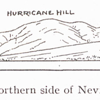
Fig. 17 — The northern side of Nevis, looking east. Image fixe
Fig. 18 — Morne au Diable, a maturely dissected volcano at the northern end of Dominica. Image fixe
Fig. 19 — Morne au Diable (from U. S. Hydrogr. Office Chart N0. 1318). Image fixe
Fig. 2 — Saba Island (from U. S. Hydrogr. Office Chart No. 1011) Image fixe
Fig. 20 — The southwestern coast of Dominica. Image fixe
Fig. 21 — An embayed and cliffed part of the east coast of Dominica (from U. S. Hydrogr. Office Chart No. 1318). Image fixe
Fig. 22 — Cliffed headlands of southwestern Martinique. Image fixe
Fig. 23 — Cliffed headlands of southern Martinique. Image fixe
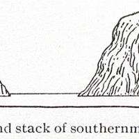
Fig. 24 — Cliff and stack of southernmost Martinique. Image fixe
Fig. 25 — The embayed and cliffed coast of southwestern Martinique (from British Admiralty Chart No. 371). Image fixe
Fig. 26 — The embayed coast and coral reefs of eastern Martinique (from British Admiralty Chart No. 371). Image fixe
Fig. 27 — The mud flow of southwestern St. Lucia, by which several to the main island. Image fixe
Fig. 28 — The Grand Piton, on the southwest coast of St. Lucia, where it is adjoined by the cliff-margined mud flow; looking northwest. The Petit Piton rises in the background. Image fixe
Fig. 29 — The Petit Piton, next north of the Grand Piton on the southwest coast of St. Lucia; looking east. Image fixe
Fig. 3 — One of the Saints, south of Guadeloupe, with moderately cliffed headlands between well-developed drowned-valley embayments; looking west Image fixe