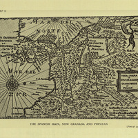
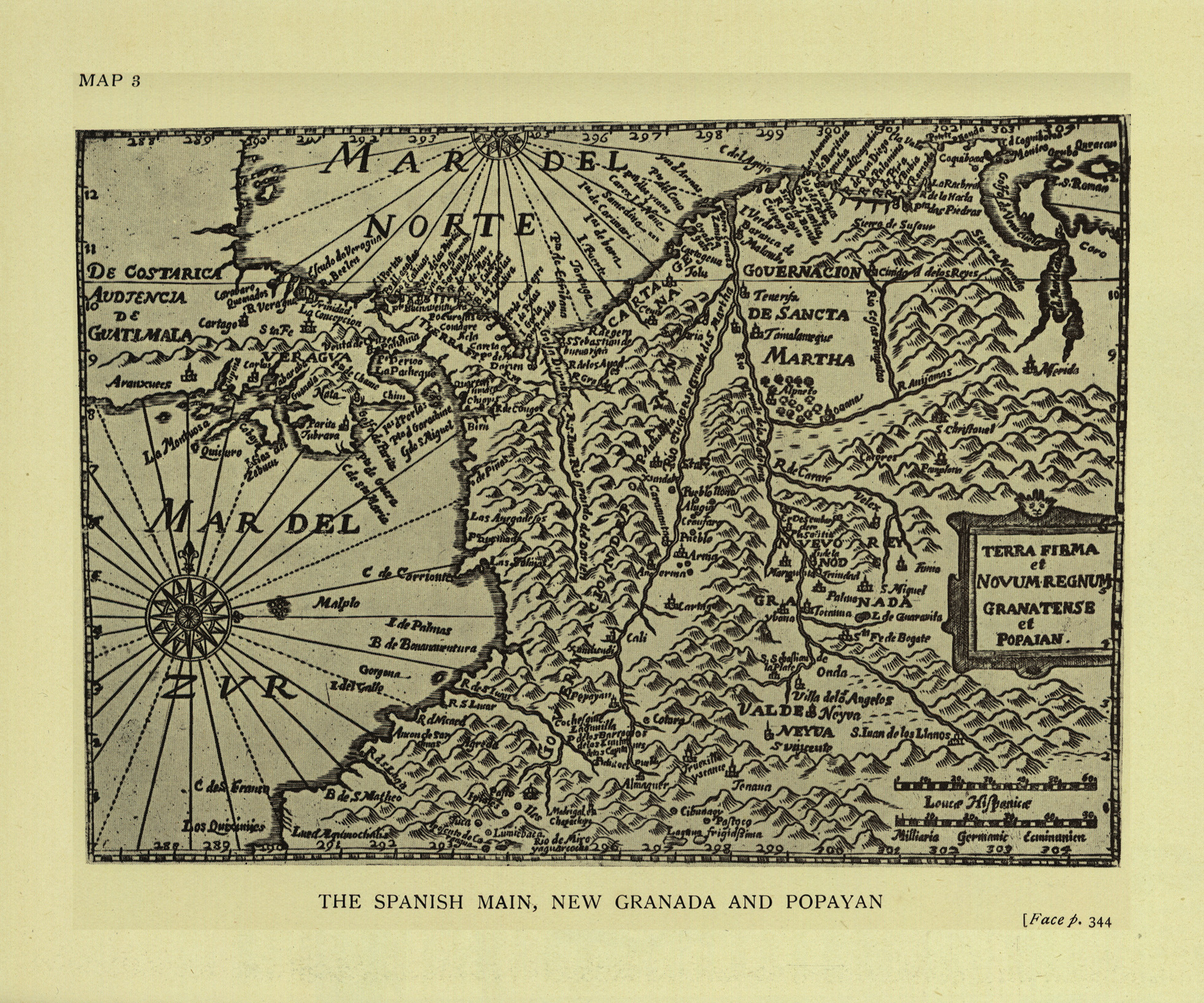
The Spanish main, new Granada and Popayan
Contenu
-
Identifiant (dcterms:identifier)
-
HASH010edee6fc64baadbbe55e65
-
Légende (dcterms:title)
-
The Spanish main, new Granada and Popayan
-
Page (bibo:locator)
-
p. 344
-
Numéro (bibo:number)
-
344
-
Description (dcterms:description)
-
Carte de la Colombie au 17e siècle
-
Mot-clé Lieu (dcterms:spatial)
-
fr
Colombie
-
Mot-clé Siècle (dcterms:temporal)
-
17
-
Type (dcterms:type)
-
fr
Carte, plan
-
Format (dcterms:format)
-
image/jpeg
-
Conditions d'utilisation (dcterms:rights)
-
fr
Domaine public
-
Plateforme source (dcterms:provenance)
-
Bibliothèque numérique Manioc
 The English-American : A New Survey of the West Indies, 1648
 Université des Antilles